
Problem
What needed to be understood or measured
An agricultural rover needs a stable reading of the traversable corridor while distinguishing plants, trunks, soil, and sky under changing field conditions.
My contribution
My contribution
I contributed computer-vision work with SeTeL, including the training and inference workflow, field demonstration, and image-space row-guidance utility.
Experimental setup
Data and setup
A Roboflow YOLOv8 export containing 193 annotated images: 183 training images and 10 validation images across plant, sky, soil, and trunk classes.
Method
From input to interpretable output
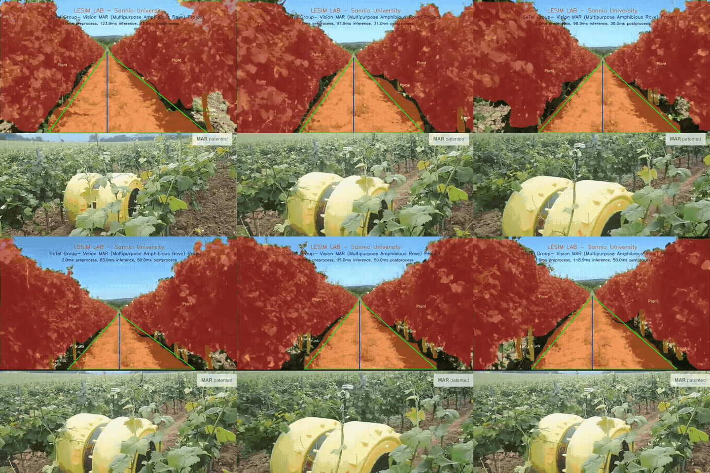
YOLOv8 segmentation identifies scene regions. A guidance utility keeps the ground-connected soil component, samples its centre across horizontal scan lines, and returns a centreline with normalized lateral offset.
 Open figure —
Field demonstration of the perception output; it does not show closed-loop autonomous control.
Vineyard_STLcompany repository.Validation & uncertainty
Reference and uncertainty checks
The repository preserves the dataset configuration and a 63-second field demonstration. It does not claim closed-loop vehicle control or a production autonomy benchmark.
Limitations & failure modes
Operating limits and failure modes
Strong shadows, vegetation crossing the soil corridor, missing soil at the image base, camera pitch changes, and multiple disconnected soil regions can destabilize image-space guidance.
This is visual guidance, not a motor-control loop. Safe steering still needs calibration, coordinate transforms, sensor fusion, speed-aware control, and a hardware-specific safety interface.
Technical stack
Tools selected for the measurement chain
- Python
- YOLOv8 segmentation
- OpenCV
- Roboflow
- Image-space guidance
Sources & project links
Papers and code
Public repository maintained by Arman with SeTeL project media and explicit boundaries around guidance, control, and field validation.